Land Surveying Calculator: Levelling, Area & Traverse Calculation Guide
Surveying is the science of determining the positions of points on or near the earth’s surface and preparing plans and maps from field measurements. It is the foundation of all civil engineering projects — roads, buildings, bridges, dams, and pipelines all begin with accurate survey data. This guide covers the essential surveying calculations used in everyday civil engineering practice.
1. Levelling: Height of Instrument (HI) Method
Differential levelling determines the difference in elevation between points. In the HI method: RL of instrument station = RL of starting BM + BS (back sight); RL of any point = HI − FS (fore sight). Check: ΣBS − ΣFS = Last RL − First RL (closure check).
2. Area Calculation Methods
Coordinate Method (Most Accurate): For a polygon with vertices at coordinates (x1,y1), (x2,y2)...(xn,yn):
Area = ½ |∑(xn × yn+1 − xn+1 × yn)|
Trapezoidal Rule: Area = h/2 × (first ordinate + last ordinate + 2 × sum of intermediate ordinates), where h = uniform horizontal distance between ordinates.
Simpson’s Rule (One-Third Rule): More accurate for curved boundaries. Area = h/3 × (first + last + 4×even + 2×odd ordinates). Requires odd number of ordinates.
3. Compass Traversing & Bearing Calculations
A traverse is a series of connected survey lines. Bearings (direction of each line) can be: Whole Circle Bearing (WCB): 0° to 360° measured clockwise from north; Reduced Bearing (RB/Quadrant Bearing): 0° to 90° in each quadrant (N, E, S, W). Converting between them: NE quadrant: RB = WCB; SE quadrant: RB = 180° − WCB; SW quadrant: RB = WCB − 180°; NW quadrant: RB = 360° − WCB.
4. Error of Closure in Traversing
For a closed traverse to “close” mathematically: ΣLatitude = 0 and ΣDeparture = 0, where Latitude = length × cos(bearing) and Departure = length × sin(bearing). Closing error = √(e_L² + e_D²). Accuracy = 1 in (Total perimeter / Closing error). Acceptable accuracy: 1/1000 for rough surveys; 1/3000 for ordinary work; 1/10000 for precise surveys.
5. Frequently Asked Questions
Q1: What instruments are used in modern surveying?
Total Station (electronic theodolite + distance meter); GPS/GNSS (Global Navigation Satellite System); Level instrument (auto level, digital level); Drone photogrammetry (aerial survey); Laser scanners (3D point cloud); Traditional chain and compass for basic surveys. Total stations can achieve angular accuracy of 1″ and distance accuracy of 1–2mm + 1ppm.
Q2: What is the difference between Benchmark (BM) and Temporary Benchmark (TBM)?
Benchmark (BM): A permanent point of known elevation established by government survey (Survey of India); based on Mean Sea Level (MSL). Temporary Benchmark (TBM): A local point of adopted elevation set up for a specific project; may be referenced to MSL or to an arbitrary datum.
Q3: What is a contour and how is it used in civil engineering?
A contour is a line on a map joining points of equal elevation. Contour interval (CI) is the vertical distance between successive contours. Closely spaced contours indicate steep ground; widely spaced indicate gentle slopes. Engineers use contours for: road alignment, site drainage design, earthwork volume calculation, reservoir capacity, and site development planning.
Q4: What is the IS code for levelling?
IS 1779: Glossary of Terms in Surveying. IS 1941: Scale for Topographic Maps. Survey of India Standards govern national-level surveys. For construction surveys, IS 6241 and IS 4890 provide guidance on geodetic surveying instruments and methods.
Q5: How do I calculate earthwork volume from survey data?
Methods: Prismoidal formula for accurate volumes; Mean Area Method (average end area method) for road embankments/cuttings; Grid method (spot heights at grid points) for site grading calculations. Software like AutoCAD Civil 3D, Civil Survey, and GIS tools automate these calculations from TIN (Triangulated Irregular Network) surfaces.
Q6: What is a Bench Mark and what elevation does Survey of India use?
Survey of India’s primary BMs are referenced to the Great Trigonometric Survey datum at Mean Sea Level (Chennai gauge station). The geodetic datum for India is the Indian Datum, now being upgraded to WGS84 compatible GRS80 ellipsoid for integration with GPS surveys. All government engineering drawings specify elevations relative to MSL unless stated otherwise.
Q7: What is GPS accuracy for construction surveying?
Standard GPS: 3–10m accuracy (insufficient for construction). DGPS (Differential GPS): 0.3–1m. RTK-GPS (Real Time Kinematic): 1–2cm horizontal, 2–3cm vertical — suitable for most construction and control surveys. PPP (Precise Point Positioning): sub-centimetre for geodetic control work.
Q8: How do I measure the area of an irregular plot?
Offline method: Divide into triangles or trapezoids and calculate each area. Coordinate method from traversed boundary (most accurate). Planimeter: mechanical or digital instrument that directly measures area from a drawing. Modern method: GPS traverse of boundary with software calculation.
Q9: What is Local Attraction in compass survey?
Local attraction is the deviation of the magnetic needle caused by nearby magnetic materials (iron fences, vehicles, reinforcing steel, electric cables). Detected when fore bearing − back bearing ≠ 180°. Corrected by working from unaffected stations outward, applying corrections to each affected station.
Q10: What is setting out of a building?
Setting out is the process of transferring the building dimensions from architectural/structural drawings to the actual site. It involves: establishing reference points from the boundary/road, marking corner points of the building footprint, checking diagonals (both diagonals should be equal for a rectangle), marking column/pile centres, and establishing floor levels. Accuracy of ±5mm in plan and ±3mm in level is typically required for RCC construction.
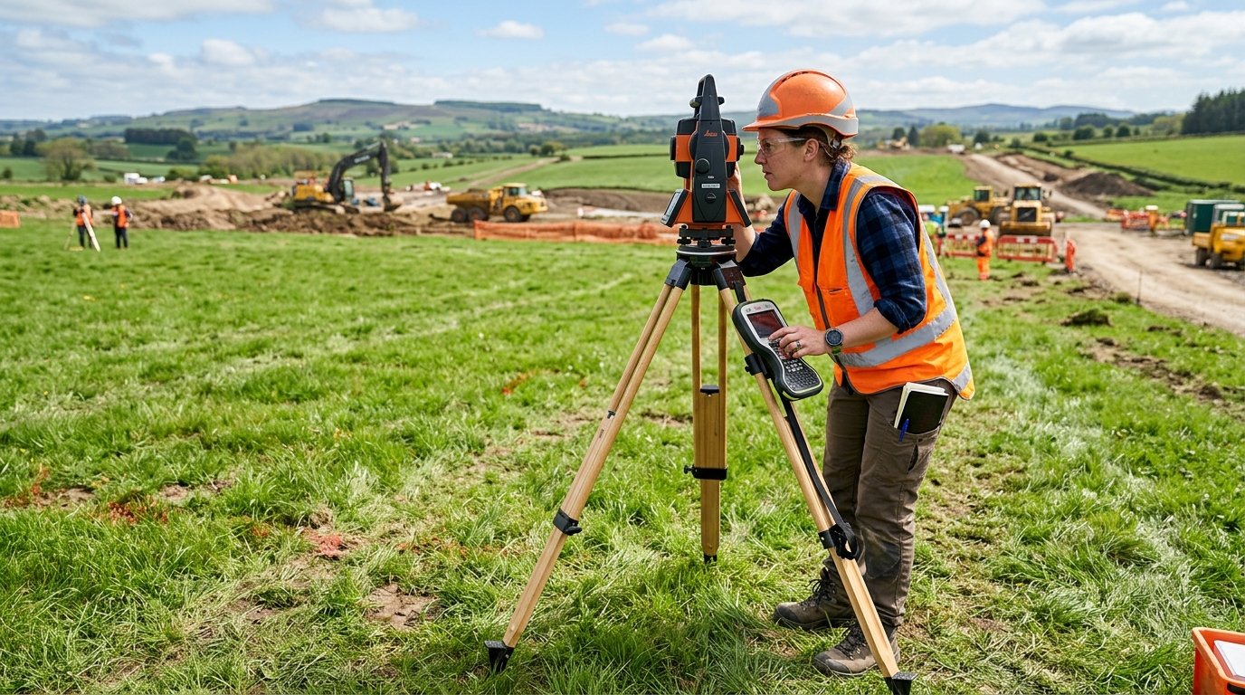 Civil land surveyor operating Total Station optical level instrument for plot layout and contour surveying.